| HOME | ABOUT US | SERVICES | GETTING STARTED | GIS MAPPING | SAMPLES | CONTACT US |

The Kandiyohi County Web mapping application allows users to access County Data from the convenience
of thier home. Users can search and view Tax Parcels, Tax Information, House Addess Locations, Zoning
Information, Building Code Information and a variety of other data maintained for the County by GIS
Midwest. This application has the ability to find data by text and geographical searches, or by simply typing
in an address. Users can also Measure, Sketch and Print their own customized maps. GIS Midwest has
also incoporated many tools for County Employees to use In-House, Please contact us for additional
information and to see what we can do for you!
View the Kandiyohi County GIS Site
Screen Shots of the Kandiyohi County GIS Site:
click to view larger images
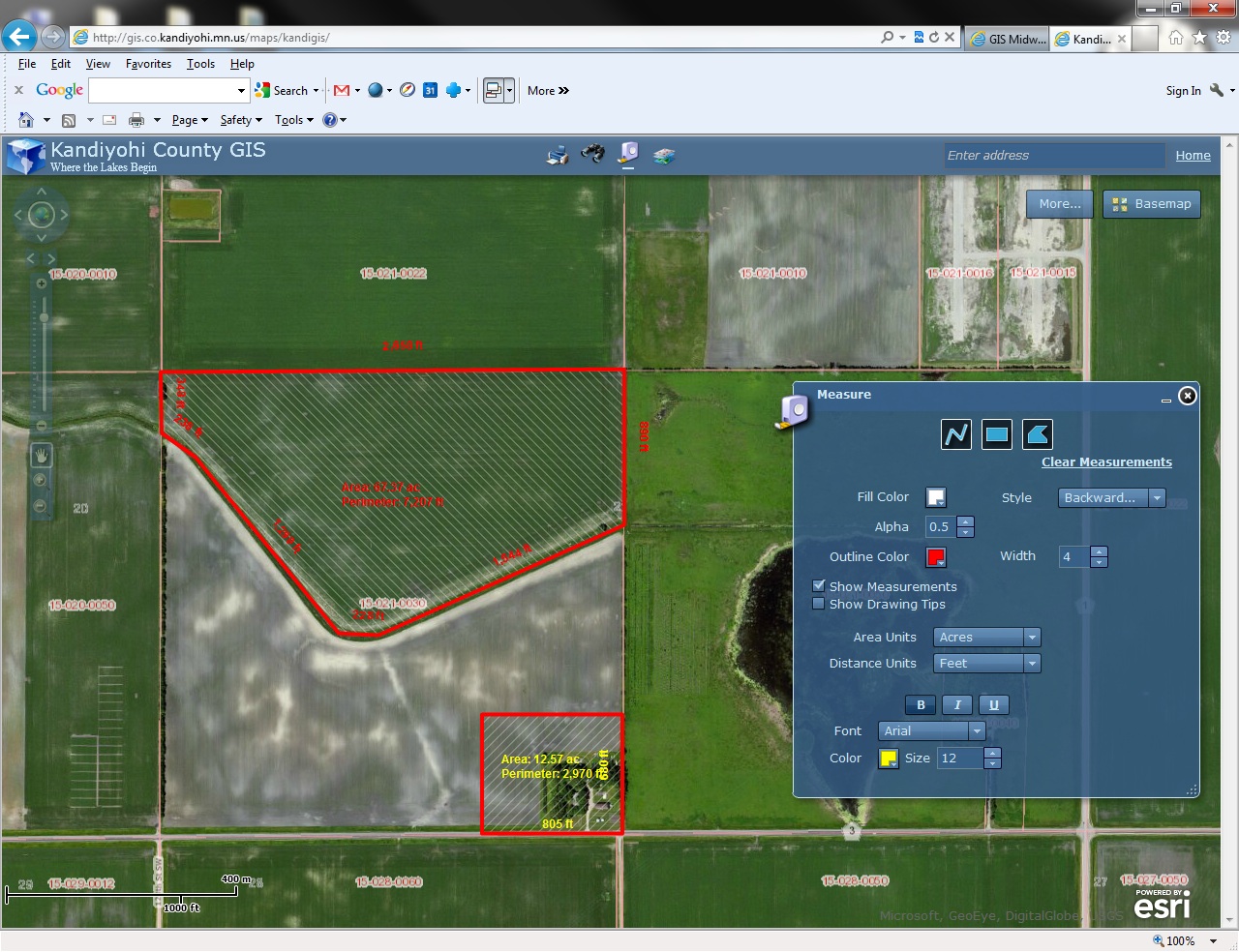
| County Zoning layer showing a legend and a popup window of the County Ordinance Document | Measure and Sketch Tool showing line segment distances, perimeter distance and area | |
 |
 |
|
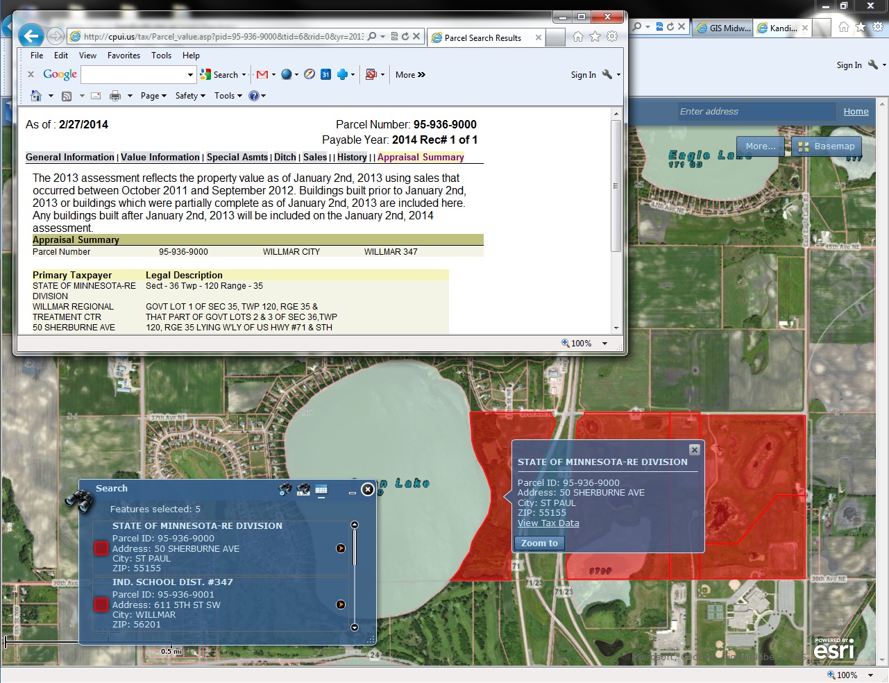
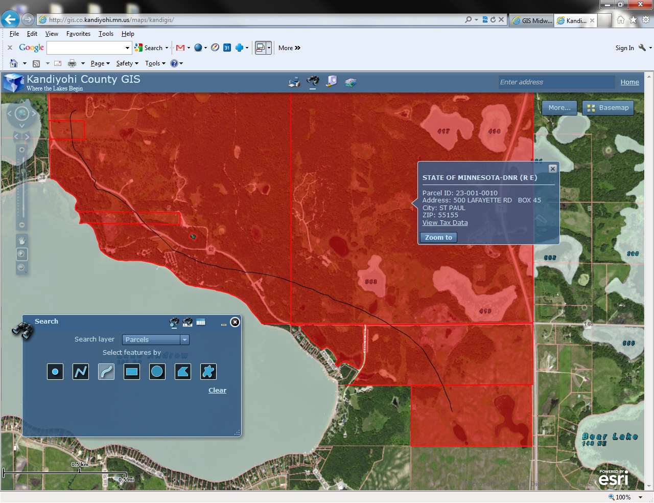
| Text Search of a Tax ID (partial), the 5 parcel results and the Tax Apprasial Data | Geographical Search of parcels using the freehand option and the selected parcels in Red | |
 |
 |